search

Trace contaminants through complex systems with CTRAN/W & CTRAN3D

Assess gas and solute transport in porous media with simple diffusion-only or complex advection-dispersion analyses

Go to storeTry it now

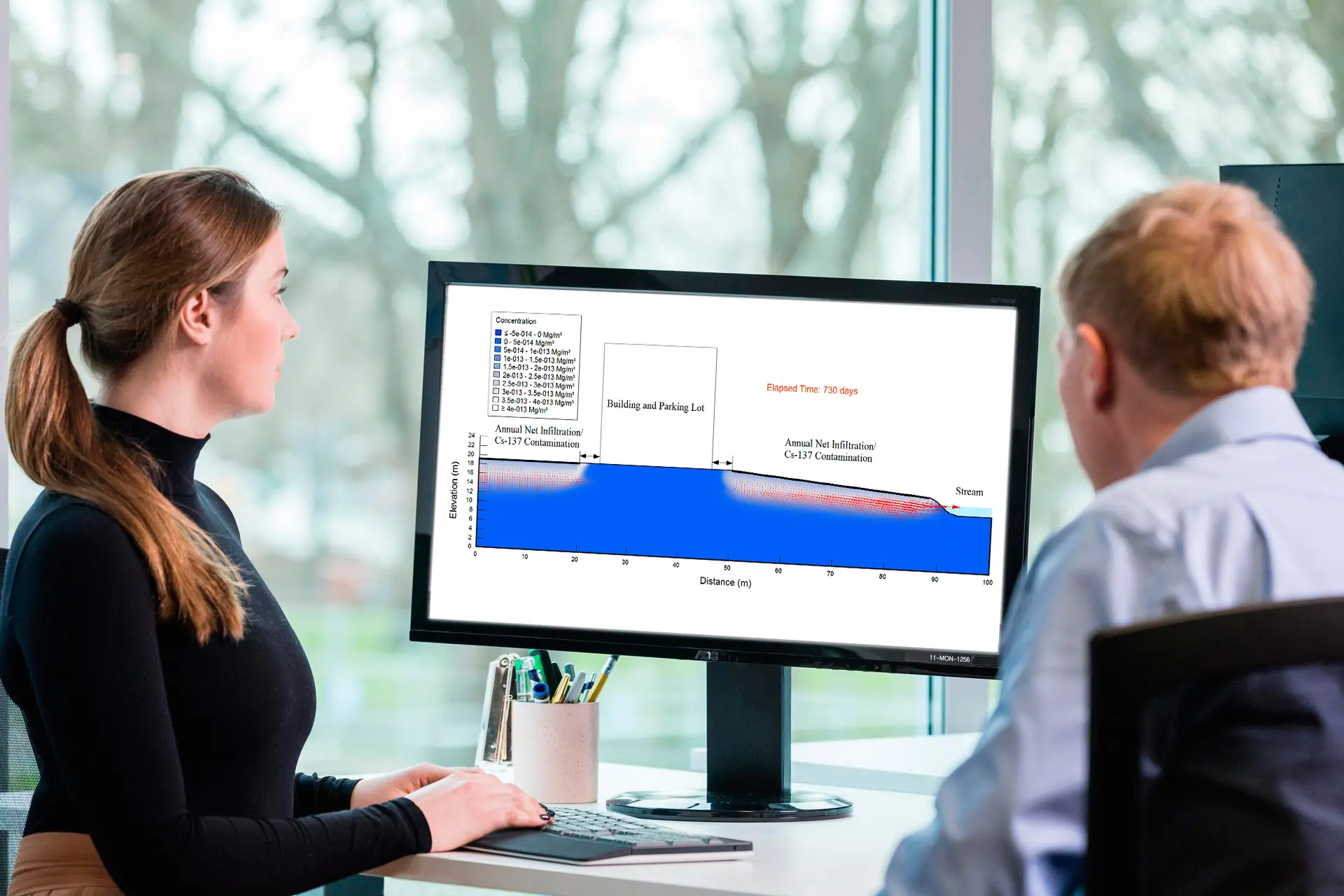
Model radioactive decay, biodegradation, oxidation, and more

Design effective ground remediation systems to ensure successful contaminant control and elimination.
Model important geo-environmental problems such as saltwater intrusion into coastal aquifers.
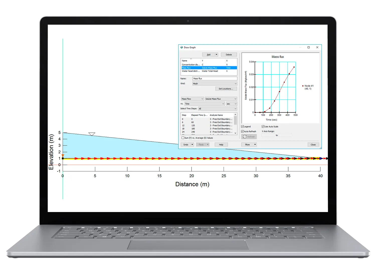
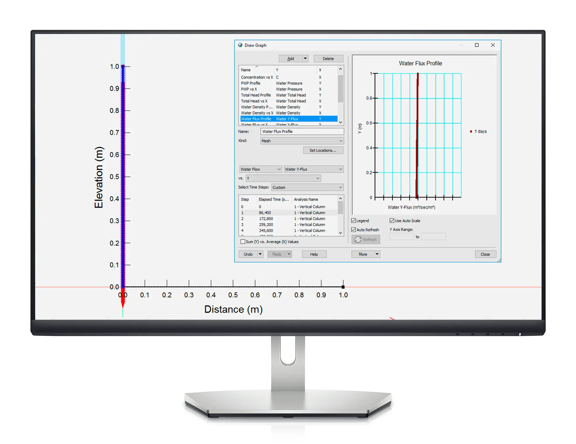
Evaluate solute and gas transport systems to ensure safer geotechnical, civil, hydrogeological, and mining engineering projects.

Reduce risk and simulate success

Simulate the mechanisms that make gas and solute flow unpredictable, including equilibrium sorption and first-order reactions such as decay, oxidation, biodegradation.

Compute the effects of various scenarios and conditions to plan for the unexpected.

Solve small and large challenges

Analyse problems from simple transport due to water movement, to complex processes involving diffusion, dispersion, adsorption, radioactive decay, and density dependencies.

Use in conjunction with SEEP/W and SEEP3D to track possible contaminant migration.

Protect groundwater systems

Evaluate possible hazards to the health of groundwater systems during geotechnical, civil, hydrogeological, and mining engineering projects.

Design liner systems that minimise the movement of solutes from municipal or industrial waste storage facilities to underlying systems.

CTRAN/W and CTRAN3D are is part of GeoStudio integrated geo-engineering software.

CTRAN/W Stories

Civil

GeoStudio 2024.1 – What’s new

GeoStudio 2024.1 continues to build on Seequent’s geotechnical analysis solution, adding new features to tackle…
A photograph of a curved road on pillars along a mountainous coastline at sunset
Civil

A Connected Geotechnical Workflow: The Key to Safe and Sustainable Infrastructure Projects

Gain knowledge of: Integrating and visualising available subsurface data Interpreting subsurface data to aid geotechnical…
A photo of OceanaGold Waihi open pit mine in New Zealand.
Case Studies

OceanaGold pilots innovative digital response for managing the Waihi Tailings Storage Facility

In an industry striving for best practice in Tailings Storage Facility management, OceanaGold’s digital response…

Integrate, communicate, and interpret geotechnical data

with industry-leading geo-engineering numerical modelling

Try it now

Key features

Comprehensive formulations for better modelling

Compute with accuracy using the comprehensive formulation and a diverse set of transport mechanisms including diffusion, advection, dispersion, adsorption, decay, and density-dependent flow.

Dual phase gas transfer

Model gas transfer in both gaseous and aqueous phases. Define the bulk diffusion coefficient, longitudinal dispersivity, and transverse dispersivity for each phase.

Integrate water data to predict flow

Compute contaminant migration by including pore-water velocity, volumetric water content, and water flux data from SEEP/W.

Control boundaries and set conditions

Analyse using a comprehensive list of boundary condition options for gas and solute transport including concentration, mass rate, mass flux, source concentration, and free exit mass flux.

Model from every angle

Model in 1D, 2D, axisymmetric or plan view, with analysis options for modelling pseudo three-dimensional problems.

Explore graphed results with GeoStudio

Plot critical information such as the spatial distribution of concentration, concentration verses time, mass fluxes, changes in mass within the domain, cumulative mass discharge, and more.

Useful Information

Use With

Solutions For

System Requirements

We recommend you use Windows 10, with a reasonably fast processor, mid range graphics and 32GB of system memory.

System Requirements

Supported Data/Formats

Supported kinds of data and formats that you can use with GeoStudio

Data Types/Formats

See pricing information

Go to store